
Lýsing
Firefly Map allows you to easily add, edit, and display city data with dynamic firefly animation effects to make your maps more attractive and visually engaging.
Key features include:
- Responsive maps powered by Leaflet
- Animated firefly effect on city markers
- Backend city management (add, edit, delete)
- Multilingual support for city info (Chinese & English)
- City status indicators (checked, recruiting, etc.)
License
This plugin is licensed under GPL v2 or later.
Skjámyndir
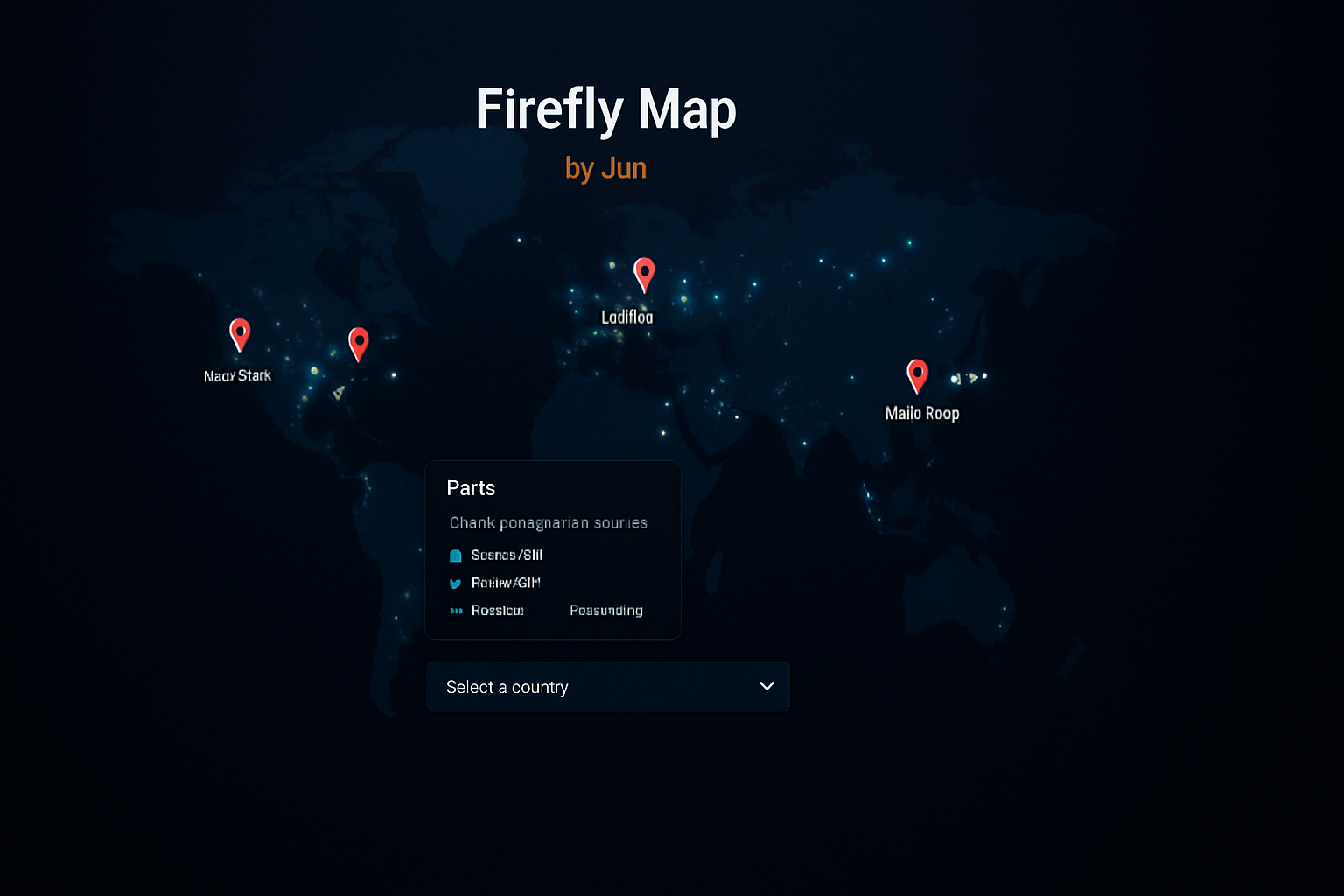
Frontend map with firefly animated city markers 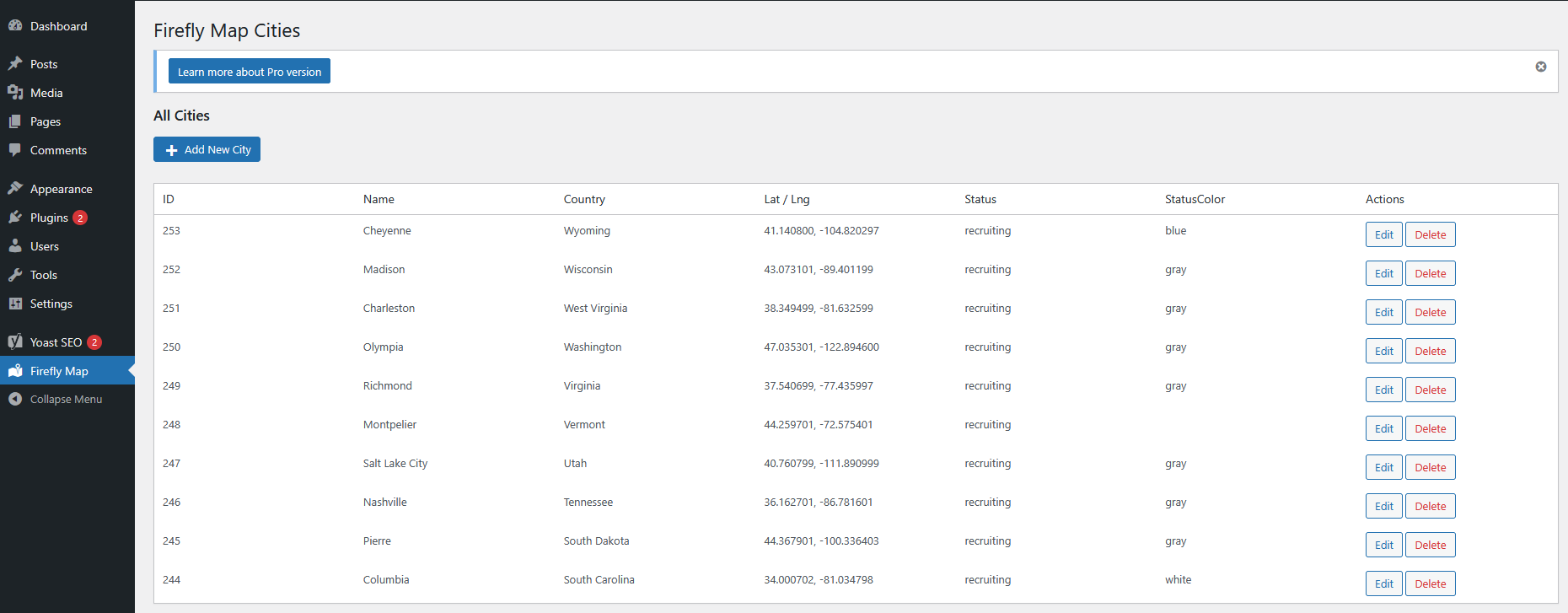
Backend city management interface 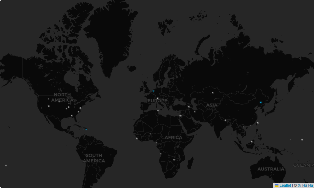
City popup example with status and multilingual info
Uppsetning
- Upload the plugin to
/wp-content/plugins/directory - Activate the plugin via WordPress admin dashboard
- Manage cities via the „Firefly Map“ menu in the dashboard
- Use the shortcode
[firefly_map]on any page or post to display the map
SOS
-
Can I use custom map tiles?
-
Yes, you can use standard Leaflet tile providers, or configure your own if they are publicly accessible.
-
Does the plugin support multilingual plugins?
-
Yes, it supports major multilingual plugins like WPML and Polylang.
Umsagnir
Þátttakendur & höfundar
“Firefly Map – Interactive City Mapping with Firefly Effect” er opinn hugbúnaður. Eftirfarandi aðilar hafa lagt sitt af mörkum við smíði þessarar viðbótar.
HöfundarTranslate “Firefly Map – Interactive City Mapping with Firefly Effect” into your language.
Interested in development?
Browse the code, check out the SVN repository, or subscribe to the development log by RSS.
Breytingarsaga
1.0
Initial release with map display, city management, firefly animation, and bilingual support.